
How to determine property slope? How to find property elevation?
I’m going to show you how you can find the slope and elevation of a property you’re thinking of buying – for free! You can do this exercise online. It only takes a few minutes and an important thing you need to check when going through your land buying checklist.

I’m going to share with you the sixth and final video in our Due Diligence series, and answer a question that you should ask when buying land: How do I check slope and elevation for a property?
If you have any questions on the content in this post, leave a comment below and I will reply with your answer.
How to Determine Property Slope and Elevation?
I am going to continue with the same example property, the one we looked up in the first five videos and articles of this series.
If you missed them, the first video goes over how to find the property owner, the second video goes over how to check for back taxes and tax liens owed on the property, the third video shows how to check the zoning of a property, the fourth video will teach you how to find access and coordinates of your property, and the fifth video will show you how to find existing utilities on a property.
If you want to check those out make sure you see our YouTube playlist for the Due Diligence video series.
This is normally not a dealbreaker for rural and vacant land. Unless you’re looking at a property in a flood zone or flood plain, or if the property slope is really severe.
It’s great to know the topography of the lot particularly if there is limited or difficult road access. It’s easy and FREE to check online, so let’s jump right in and do that.
So our example property, is a lot in Costilla County Colorado, with the parcel number of 70273760.
Where to Find Property Slope and Elevation?
You will need 2 things to find out the coordinate and access information for a property.
- You need to know the county that the land is in, so in our case, that is Costilla County.
- You will need the parcel number.
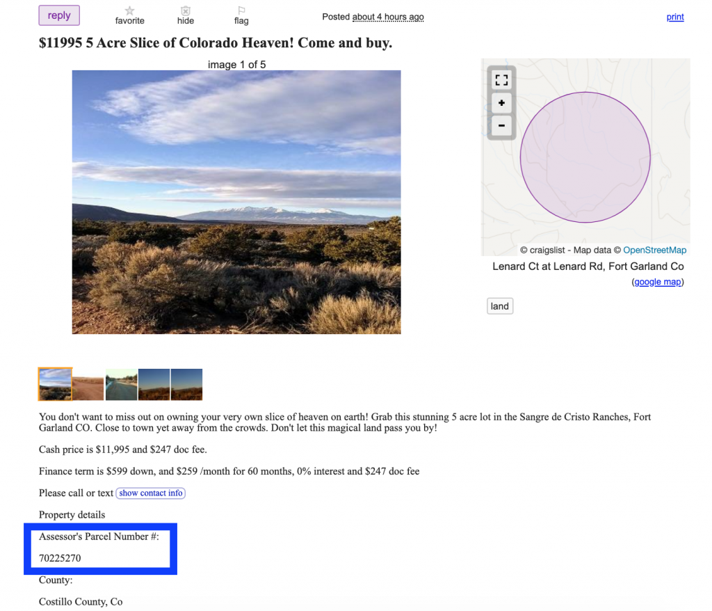
If you found a piece of property you’re thinking about buying on any of the Land sites, Craigslist, even Facebook Marketplace, you can get the parcel number right from the listing or just ask the seller and they will be able to provide you with that info.
Note: If the seller does not have the parcel number or cannot get it for you – that is a big red flag. It increases the likelihood of that seller being a scam or not having the rights to actually sell you that property.
How to Find Property Elevation?
The county that we’re doing our example in, Costilla County, has the GIS maps available online. Let’s go over to Google, search for ‘Costilla County GIS maps’.
You might want to follow along with this one. Click here to see my Google search.
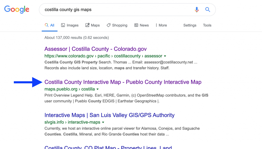
Let’s select the second site in the search.
I know, because I’ve worked and invested in Costilla County, that this particular mapping system we’ve selected is outdated. But, it still has viable topography data.
The owner’s information will not be correct, and we know that and we’re okay with it, so we’re just taking into consideration the topography data.
This is not common. Most Counties will only have one GIS system available online. If the County where you’re looking for land has two, like Costilla does, you should check both of them – but keep in mind that their information might not match completely.
In the GIS system, you will search for your parcel number, and click ‘Enter’.

So we’re going to click on ‘Basemaps’, and ‘ESRI Topography’ to get the topography info.
I’m going to remove the ‘Parcels’ layer because otherwise, it will be difficult to see the elevations.

Let’s locate our example parcel, and zoom way in here on the map. We can see the topography lines all over the County.
Let’s find the labels for the topography lines, I see one here in our parcel at 8,080ft. So that line right there represents a property elevation of 8,080ft.
How Do I Determine Property Slope?

To estimate the slope from this, what we’re going to do is draw lines from this elevation of 8,080 feet to the edge of our property.
We can do that by using the ‘Measurement’ tool in the system. We find it’s approximately 261 feet.

Now we need to find that second elevation label, (where the blue arrow is pointing in the ‘Calculate Slope’ image). We might have to track it a bit in the GIS system.
I see 8,120 feet, and 8,080 feet, so these are increments of 20 making this line here 8,100 feet.
So we have our slope formula (from high school math if anyone remembers that) of Slope = Rise/Run.
Our rise is 20 feet, and our run is 261 feet. If Slope = Rise/Run, then we have 20/261= 0.0766, multiply that by 100% to get a percentage, and that gives us a slope of approximately 7-8% in that southern area of our property.
For the northern side of the property, I wouldn’t expect the slope to change too dramatically because that topographical area is much larger between the lines over on the southern side. So I would say that the area isn’t completely flat, but mostly flat.
Find Out Property Elevation and Slope for FREE
That brings us to the end of our video series on Due Diligence and questions to ask before buying land.
We covered the most important question (who owns the property); we covered how to check property taxes and tax liens; how to check property zoning; how to access vacant land; how to check for utilities; and finally how to check the slope and elevation of a property.
So at this point, you can make an informed decision on whether or not you want to move forward with purchasing the property!
This is not a comprehensive list, but it gives you a good starting point of major issues to watch out for.
If you have stuck with me to the end of this series – thank you! I appreciate your time and hope you got some value from it.
If you enjoyed this post make sure you like it, share it, tell your friends about it, and don’t forget to subscribe to our YouTube channel so you’re the first to know when our video or property tour is published.
If you have any questions leave a comment below I’ll make sure I answer them and help you out. Thank you for reading!
Are You Looking for More Info?

How You Can Become a Land Buying Expert – Download our FREE Guide here. Or, you can feel free to contact us anytime if you have questions, want to easily and safely buy land, or want to just learn more about how we can help people like you search for land as an investment.
Get the FREE Guide and then give us a call at (313) 349-0434 and we’ll discuss how you can easily buy land with little money using our automatic approval owner financing.
The information in this article should not be interpreted as legal advice. I’m not a lawyer, and if you’re considering buying land I recommend getting help from a paralegal or lawyer to find out what your options are. It can be difficult and overwhelming to do a proper Title Search, especially to someone without experience. To be certain of what rights are included with your property, a local title agency or paralegal can help you. Leasing rights and determining access can sometimes escalate into a very difficult and troubling situation, so it’s best to get professional advice.
Baldwin co parcel number 52-07-26-0-002-067.001
Need elevation
Hi Robert and Pat! Thank you for reaching out. I tried to punch that parcel number into Gunnison County’s Assessor page, but it kept giving me an error. Is the parcel number typed out correctly?
Here’s the Assessor’s site – https://qpublic.schneidercorp.com/Application.aspx?AppID=1013&LayerID=20774&PageTypeID=2&PageID=8992&Q=1286207903
You can punch in the parcel number or owner name from there to search for the property and get some coordinates. I hope this helps! 🙂
I live in Harris County, TX. In 2018 the City if Houston dug out ditches and replaced culverts for better drainage without shooting grades of ditch etc. This was not an upgrade., and it totally ruined 62 homes that have never flooded and now do. How do I or where would I look to get a complete and accurate topography of my home’s property so as to use that information to try to find someone to repair this problem of destruction? I want the water to drain to the overflow ditch and I want my neighbors water to stay with them not come
To me. Plus, I am not sure what else to look for to correct this problem. Any advice is greatly appreciated.
Hi Gina. I’m really sorry to hear about your home flooding. That’s always an annoying and messy thing to go through. We don’t typically develop the land we own, so I’m out of my scope here. My best guess would be to hire a surveyor to understand the current topography of your property (and your neighbors) and then go to the county and town offices to talk with an engineer and press your case. Maybe they can have more drains installed on your street to help mitigate the flooding. Good luck!