2 Acres – RV Friendly! In Concho, Apache County AZ Sold
$14,999
Sold
Map
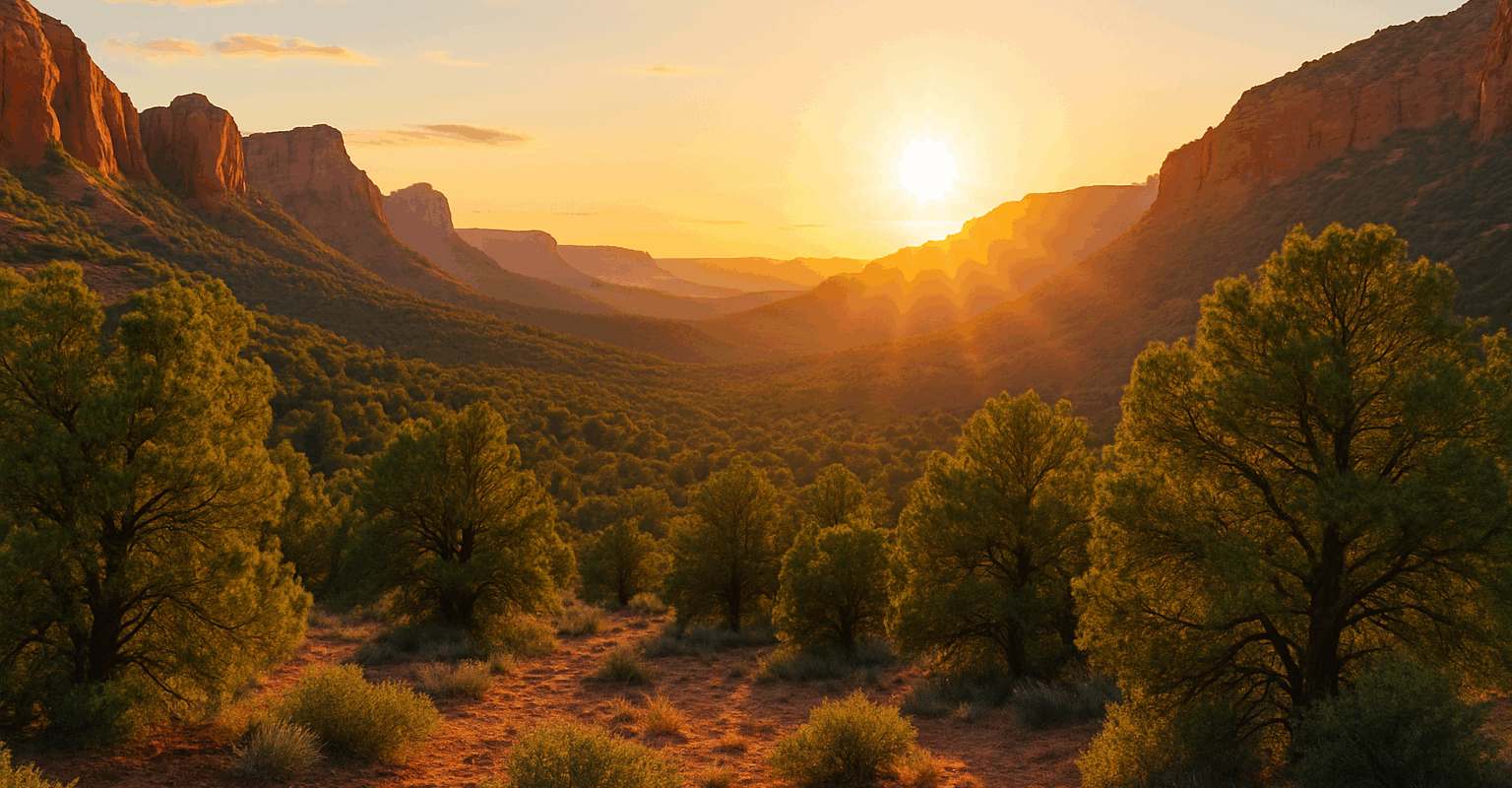
Can You Picture Yourself Here?
It rained the last couple days, typical spring weather. But you don’t care, because it’s the perfect opportunity to take the ATV out and hit some trails! A layer of mud makes it more fun.
You might even spend the night. Camping might be easier, then you don’t have to worry about driving home late. You can just cruise around and then head right for the tent.
Yup. You are ready. You’re ready for the weekend. Ready to rip around on the trails. Waiting to get that adrenaline rush!
What happens if I click these buttons? You will be taken to a secure checkout page to submit the Documentation Fee. Once processed, we will let you know and immediately start working on the sale agreement.
Want Your Own Custom Plan?
Property Details
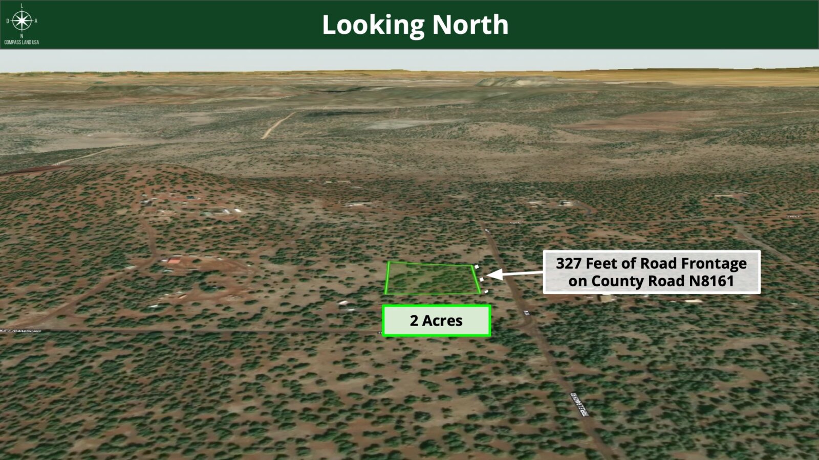
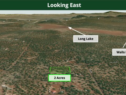
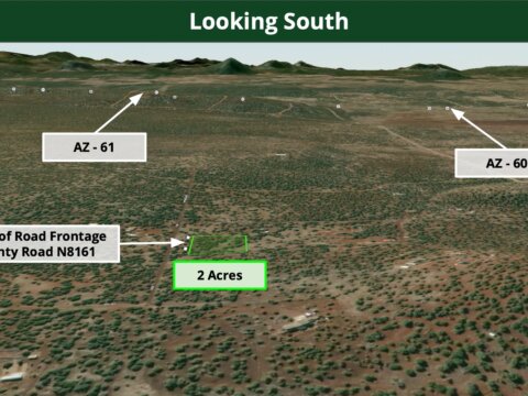
Address: Lot 22 County Rd N8161, Concho, AZ 85924
Parcel Number: 107-37-022E
County: Apache
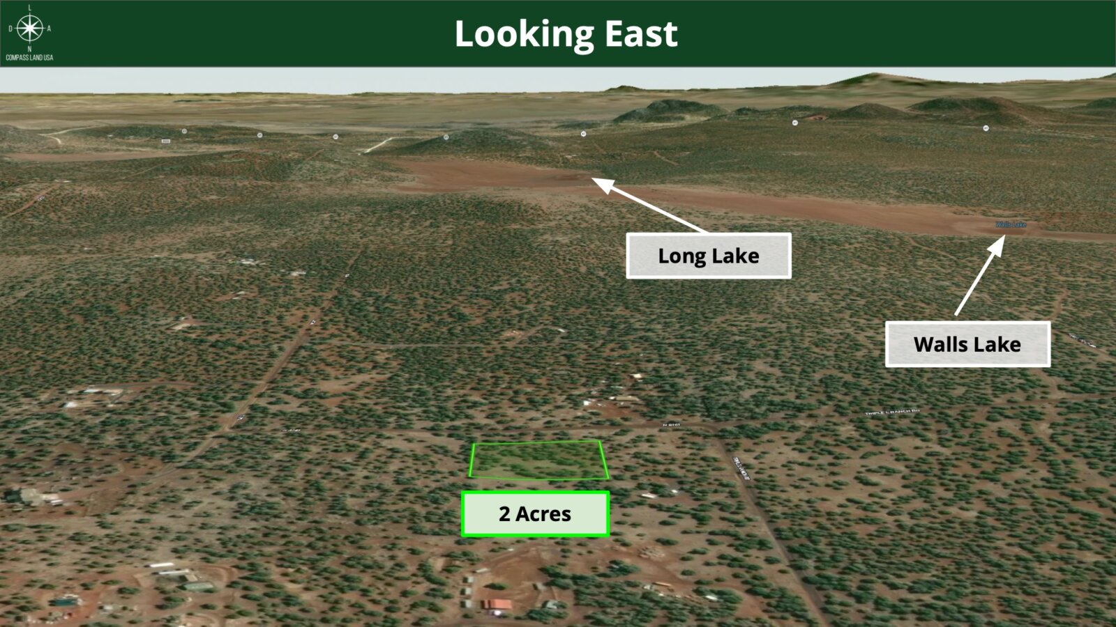
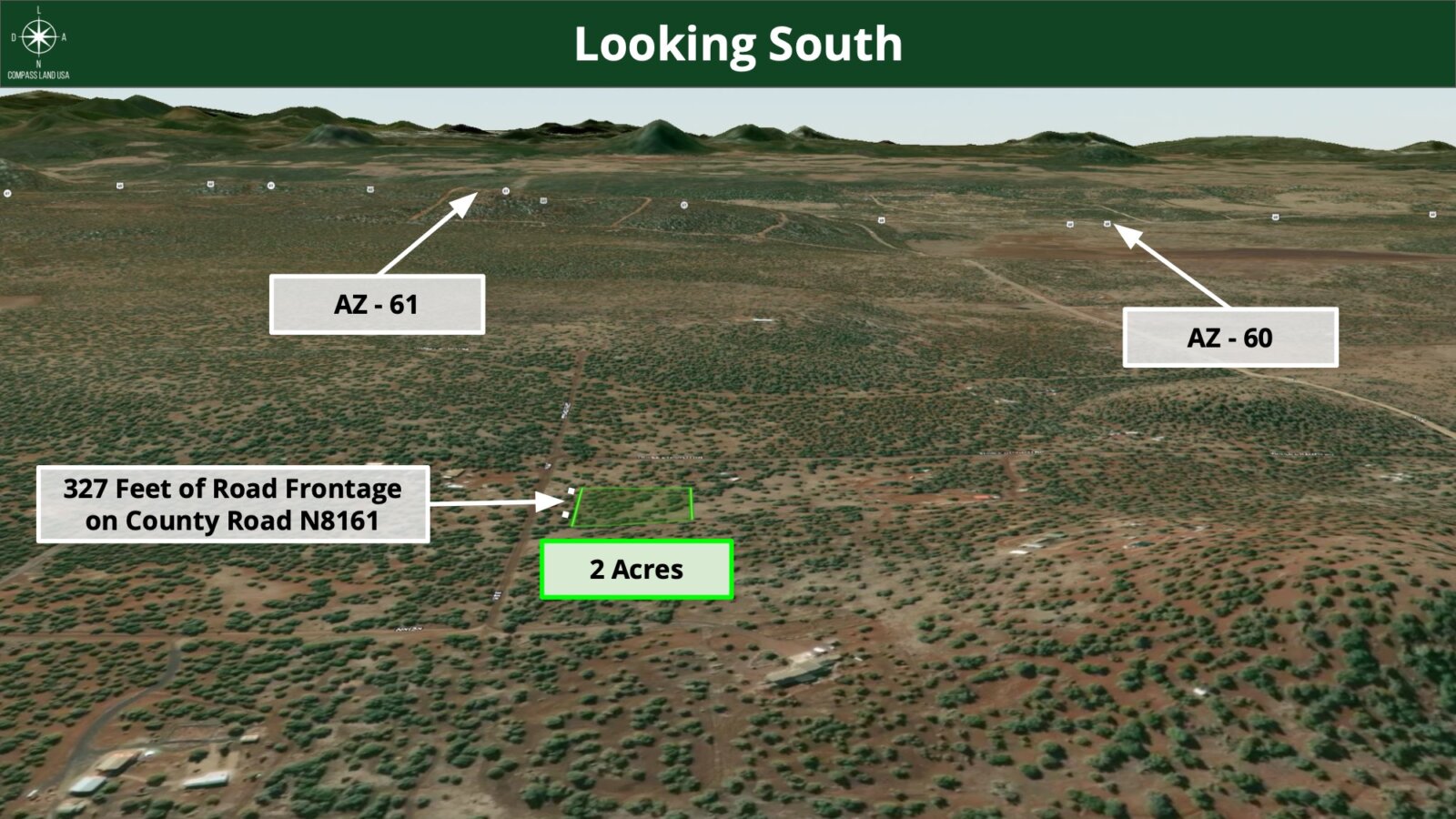
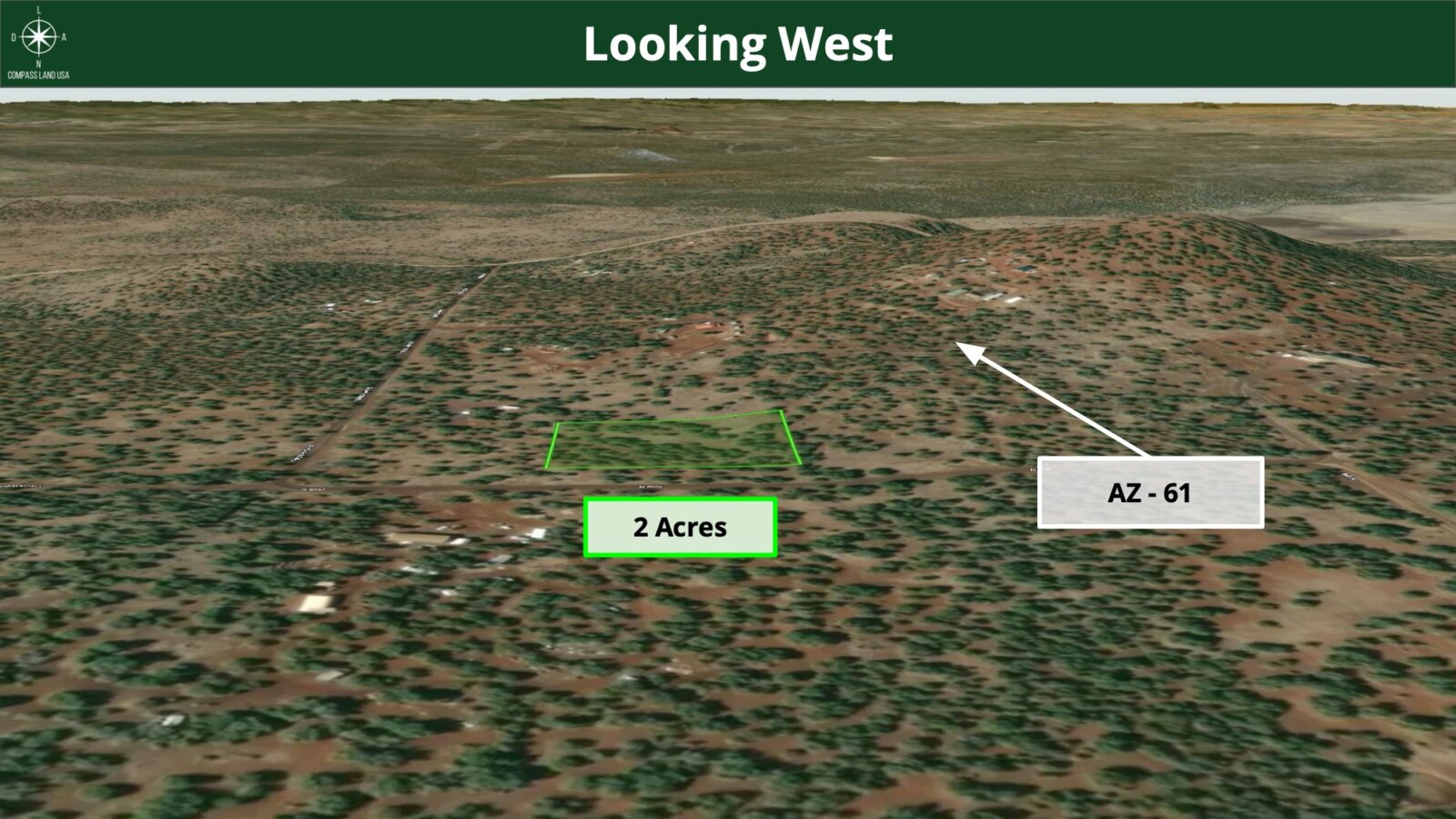
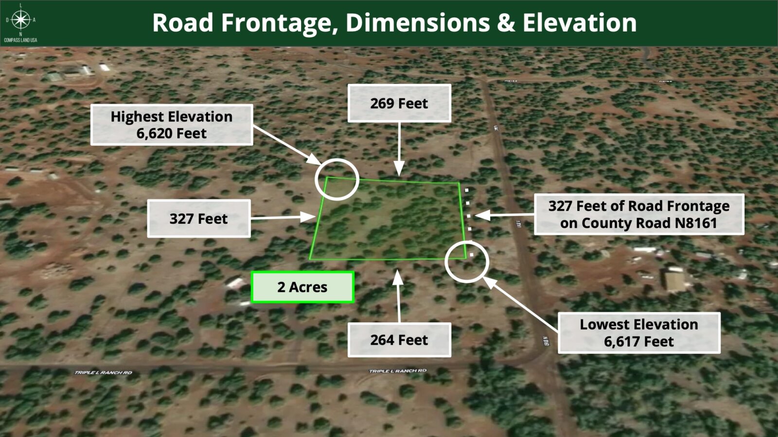
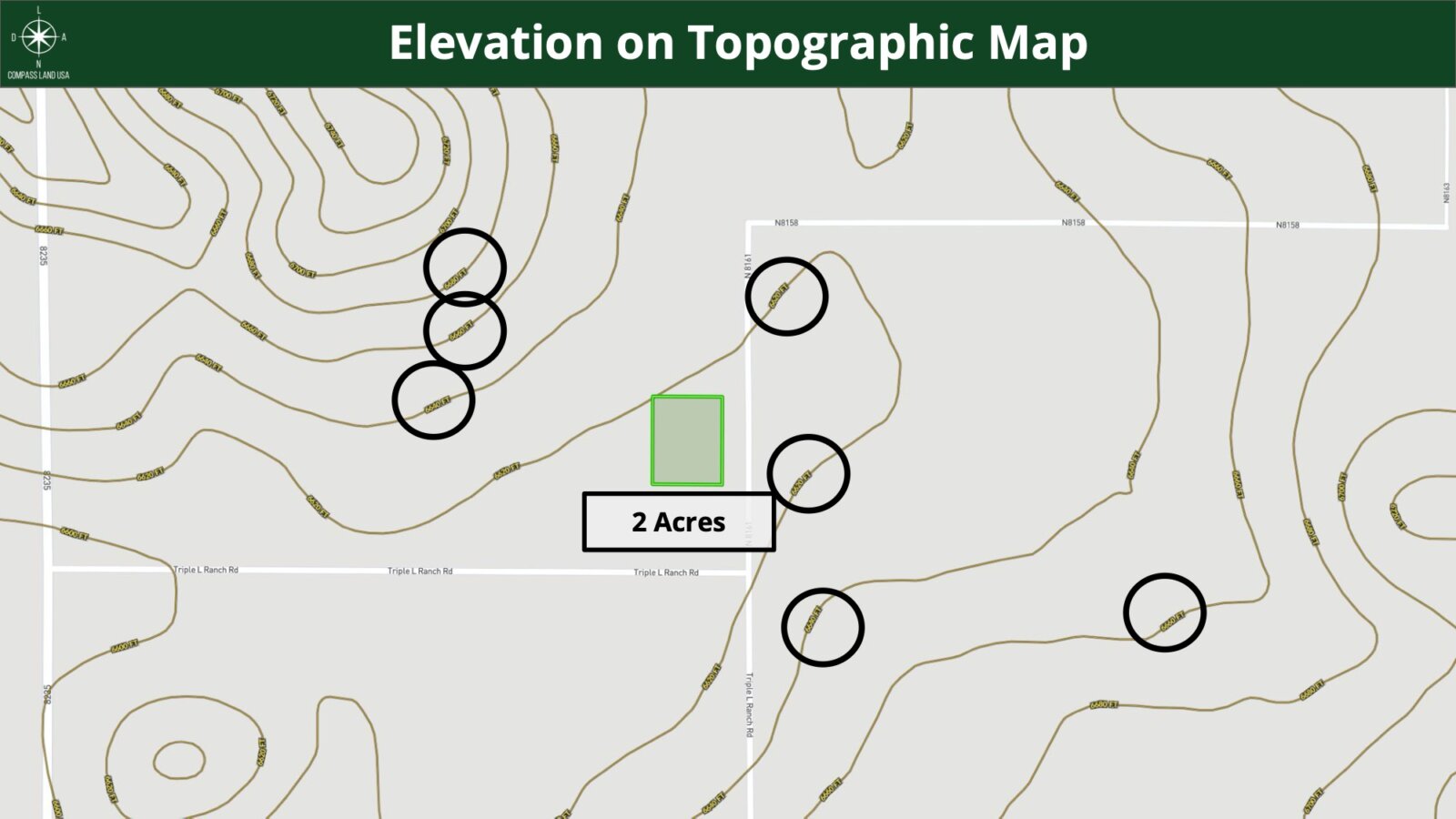
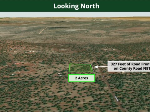
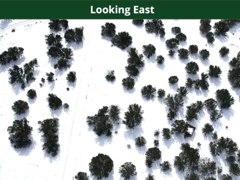
Size: 2 Acres
Legal Description: THAT PARCEL OF LAND BEING PART OF TRACT 22, SECTION 29, TOWNSHIP 11 NORTH, RANGE 24 EAST OF THE GILA AND SALT RIVER BASE AND MERIDIAN, AS SHOWN ON RECORD OF SURVEY RECORDED IN BOOK 5 OF TOWNSITE MAPS, PAGE 55 AND BY BOOK 1 OF LAND SURVEYS, PAGE 116, RECORDS OF APACHE COUNTY, ARIZONA, SAID PARCEL BEING MORE PARTICULARLY DESCRIBED AS FOLLOWS;
COMMENCING AT THE SOUTHEAST CORNER OF TRACT 22, SAID CORNER BEING MONUMENTED BY A 5/8 INCH REBAR AND ALUMINUM CAP/LS5570;
THENCE NORTH 00°09’21” WEST A DISTANCE OF 330.60 FEET TO A ½ INCH REBAR/LS22754 AND THE NORTH LINE OF THAT PARCEL AS RECORDED IN FEE# 2001-06609, APACHE COUNTY RECORDS;
THENCE SOUTH 89°21’10” EAST ALONG SAID NORTH LINE A DISTANCE OF 263.62 FEET TO A ½ INCH REBAR/NOTAG AT THE NORTHEAST CORNER OF THAT PARCEL LAST DESCRIBED;
THENCE SOUTH 00°09’22” EAST, ALONG SAID EAST LINE OF THAT PARCEL LAST DESCRIBED, A DISTANCE OF 330.48 FEET BACK TO THE POINT OF BEGINNING.
EXCEPT ALL OIL, GAS AND MINERALS AS RESERVED IN INSTRUMENT RECORDED IN DOCKET 213, PAGE 59.
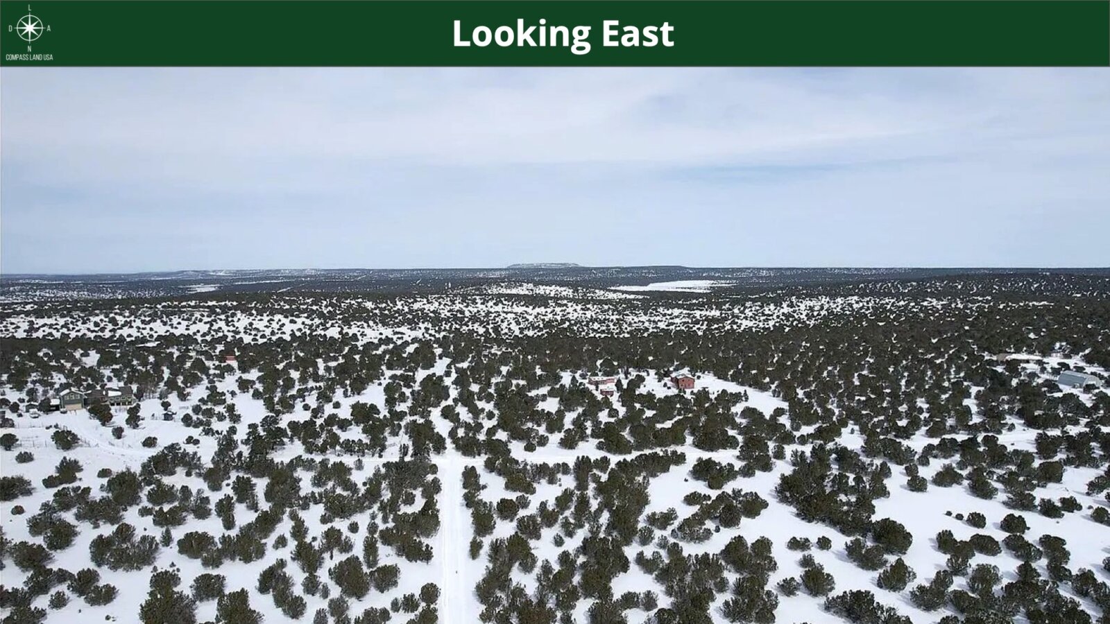
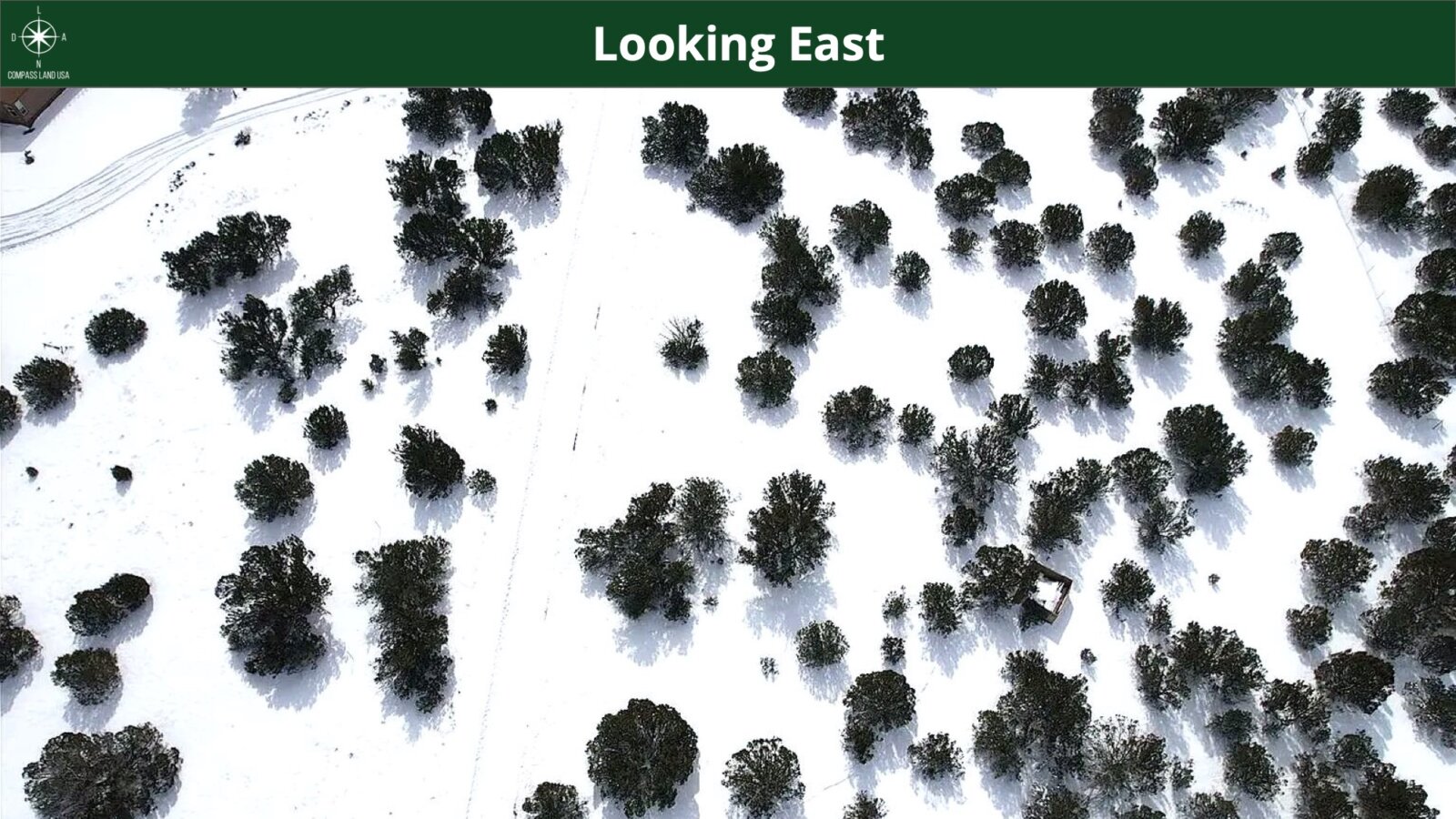
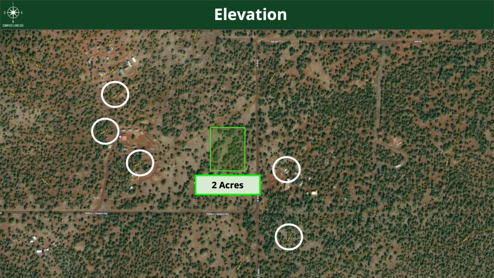
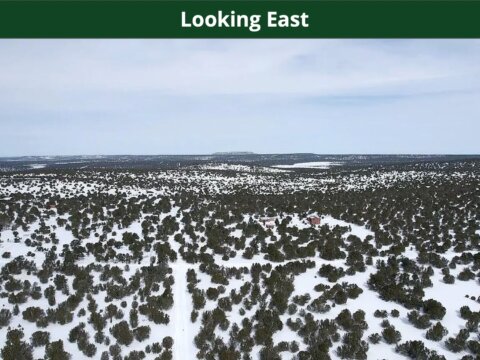
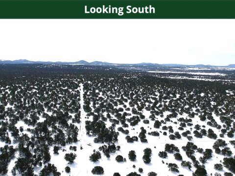
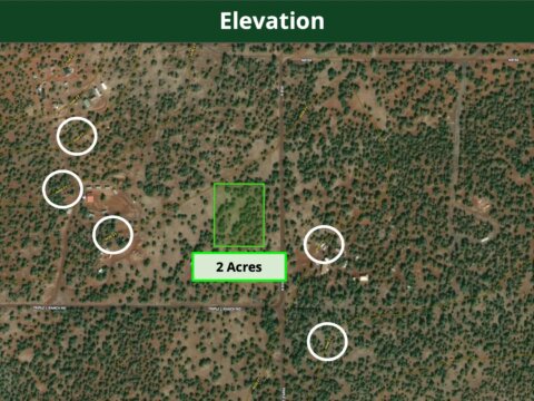
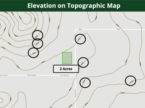
Terrain: Level
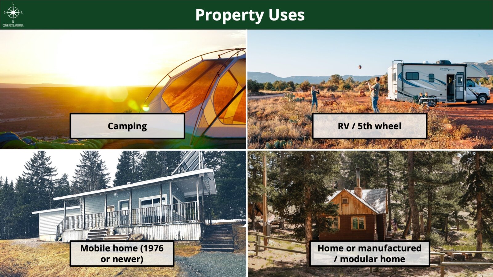
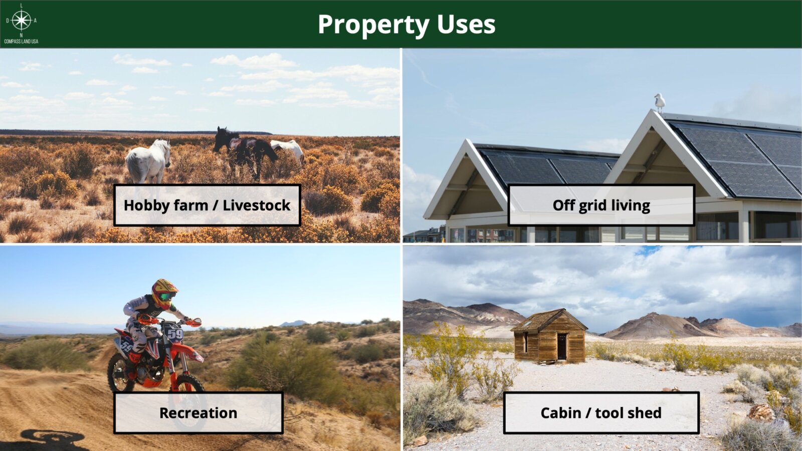
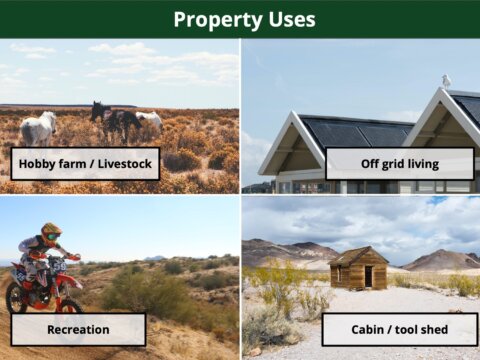
Zoning: Agricultural
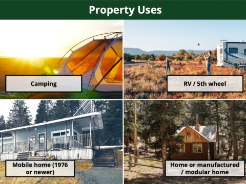
Camping and RV: Allowed in general for most Agricultural zoned areas. RV is allowed for 2 years while building.
Power: Would be Alternative (Solar, Generator, etc)
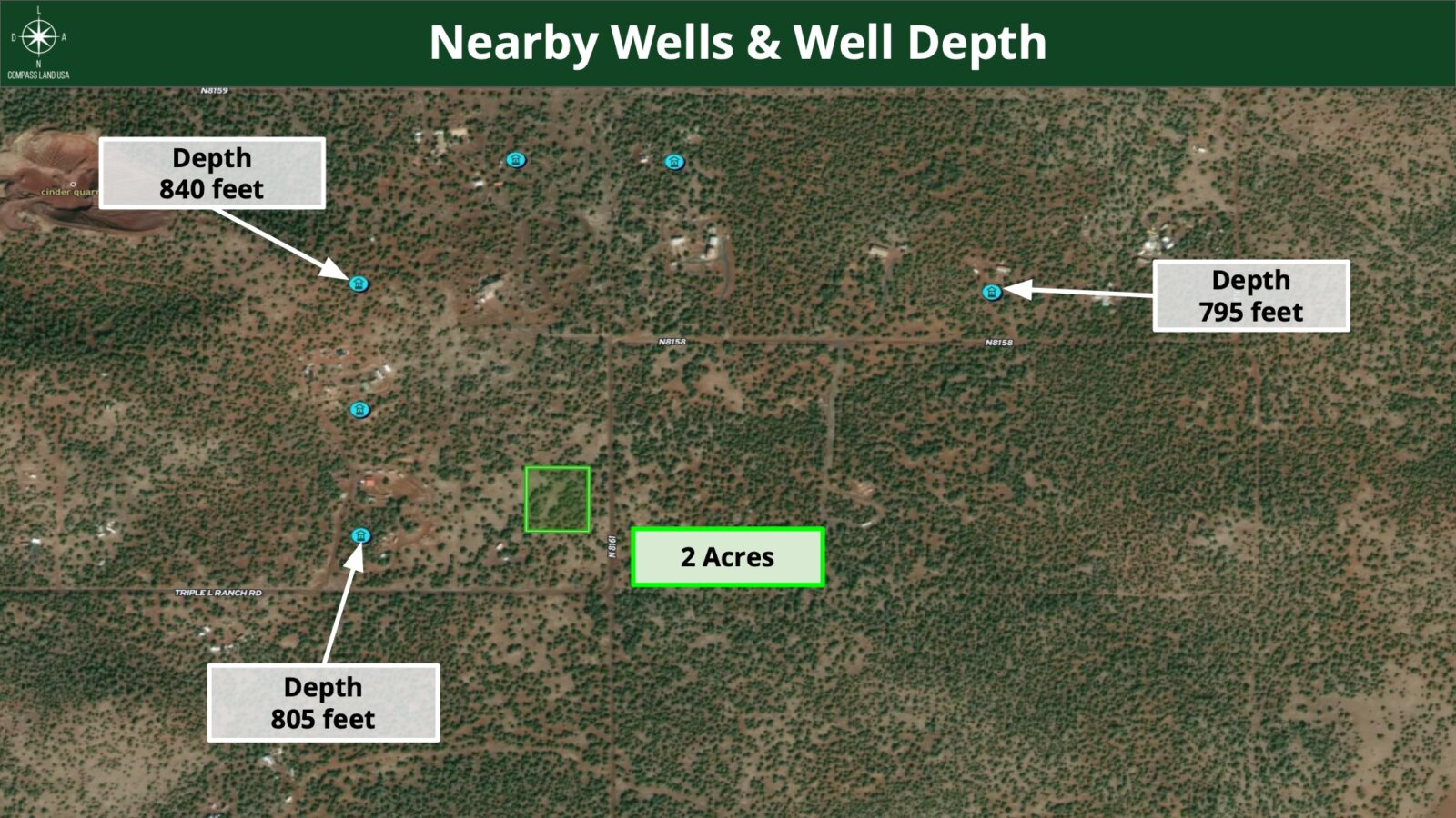
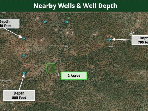
Water: Would Be Well
Sewage: Septic can be installed
Flood Zone: No
Annual Property Taxes: $84
Access: Dirt Road
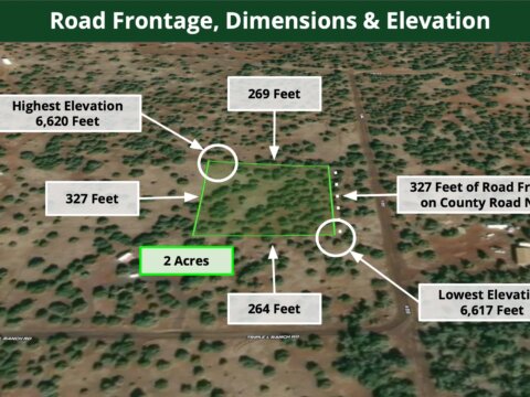
Dimensions (Feet): 269 x 327 x 264 x 327
Hoa: None
Conveyance: Warranty Deed
Title: Free and Clear
Google GPS Corner Coordinates
NW: 34.325058, -109.822975
NE: 34.325053, -109.822095
SW: 34.324149, -109.82297
SE: 34.324145, -109.822087
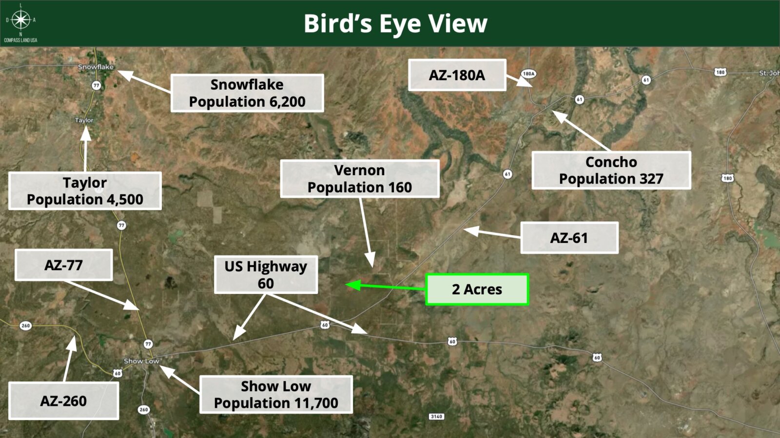
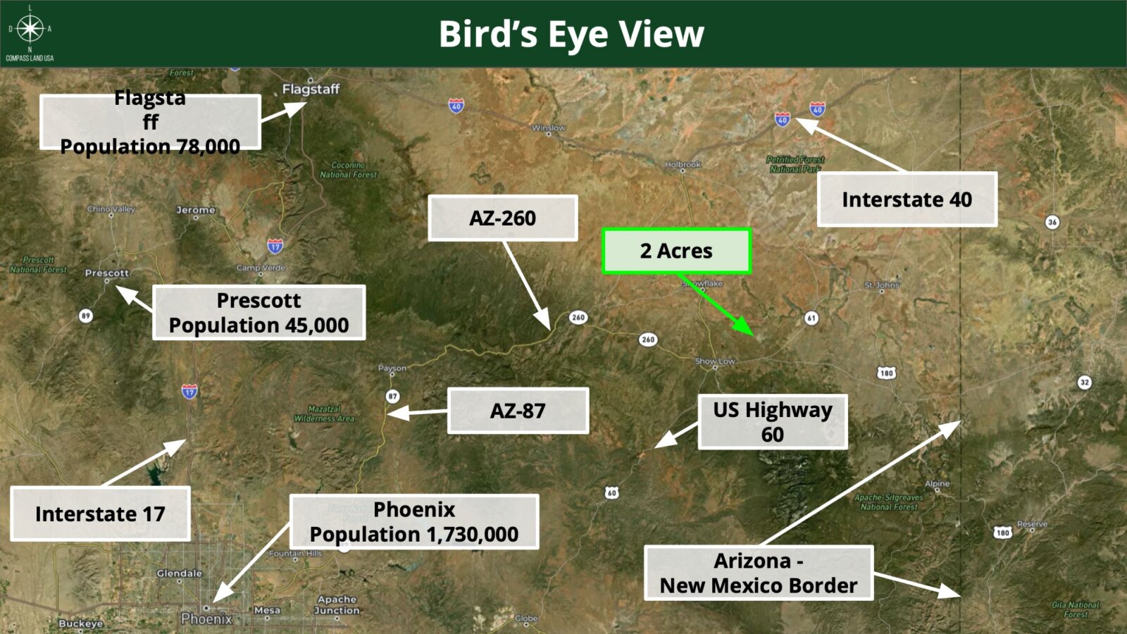
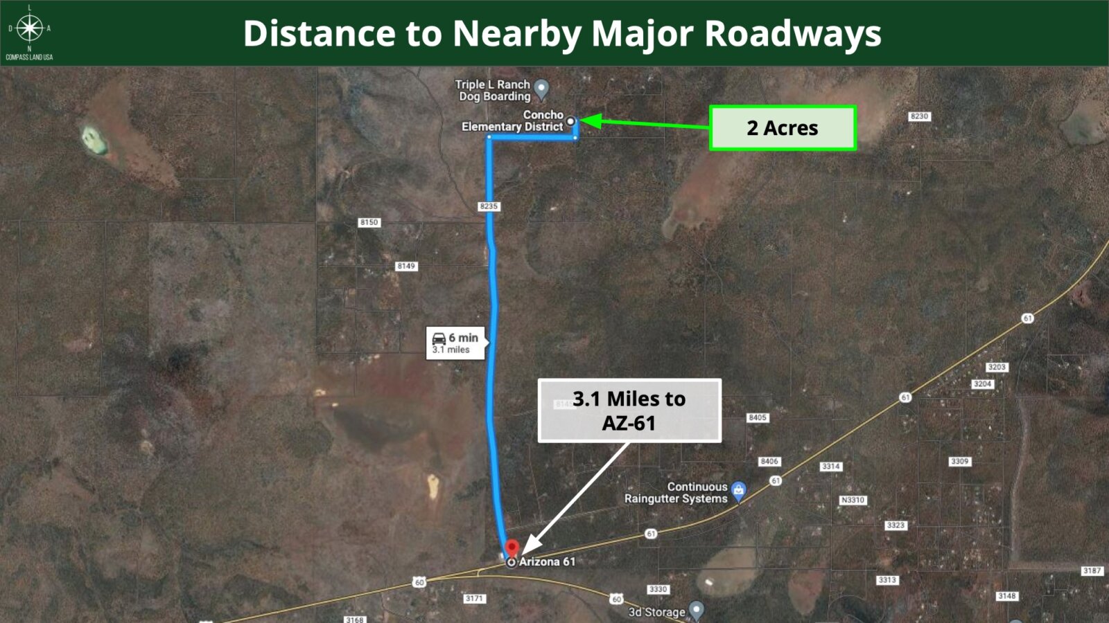
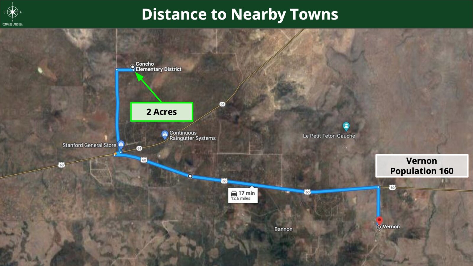
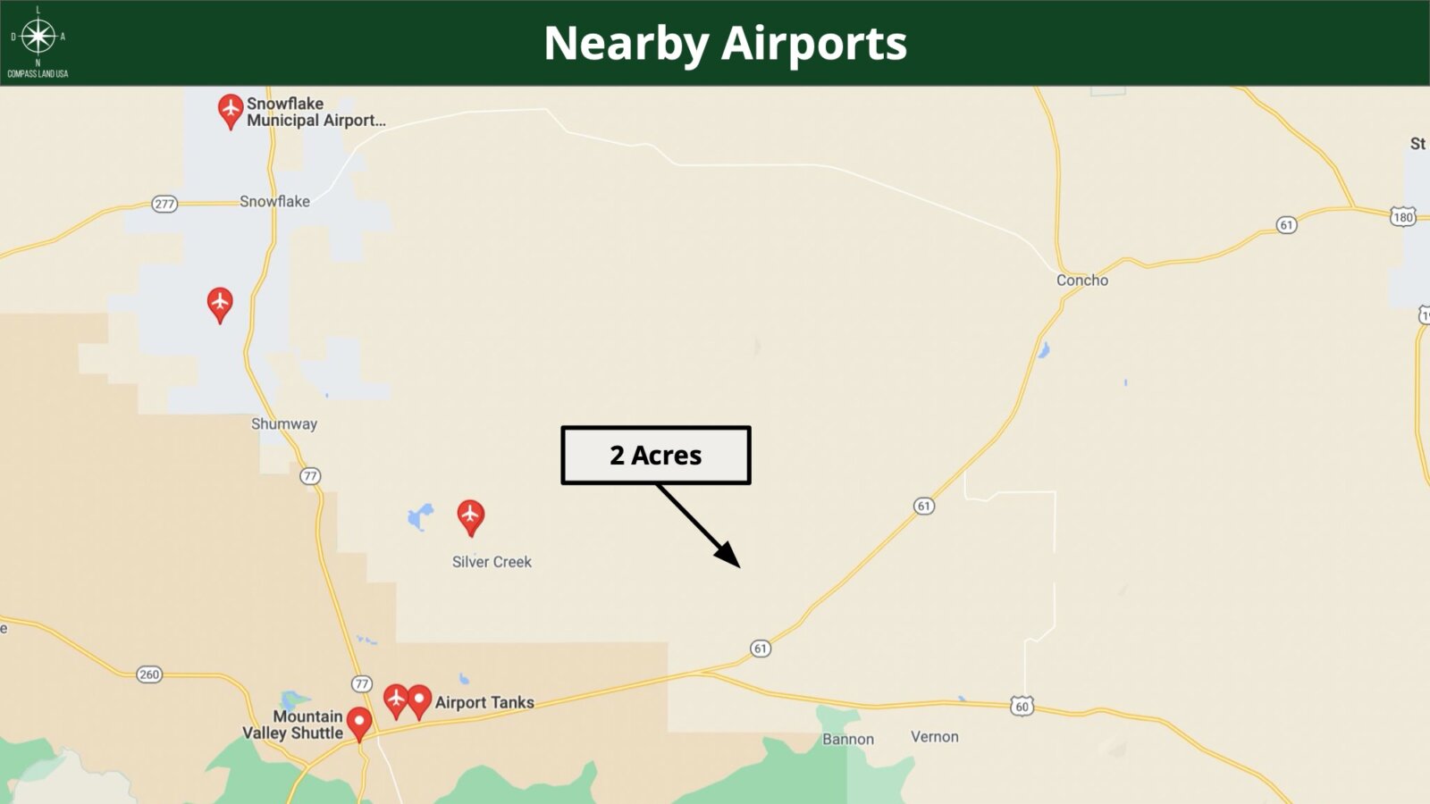
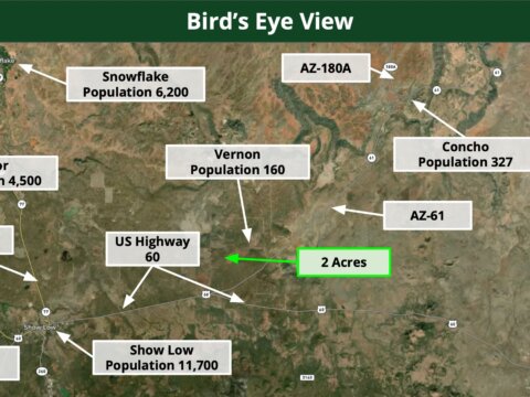
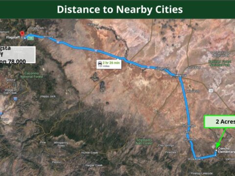
Approximate Distance to Nearby Cities
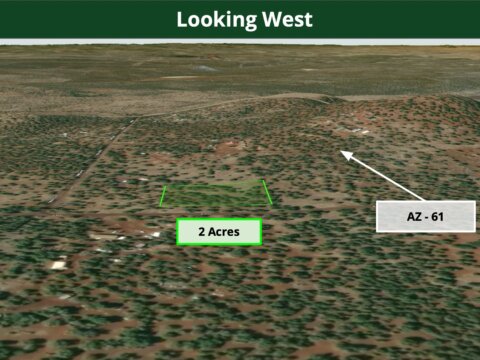
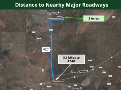
6 minute to AZ – 61
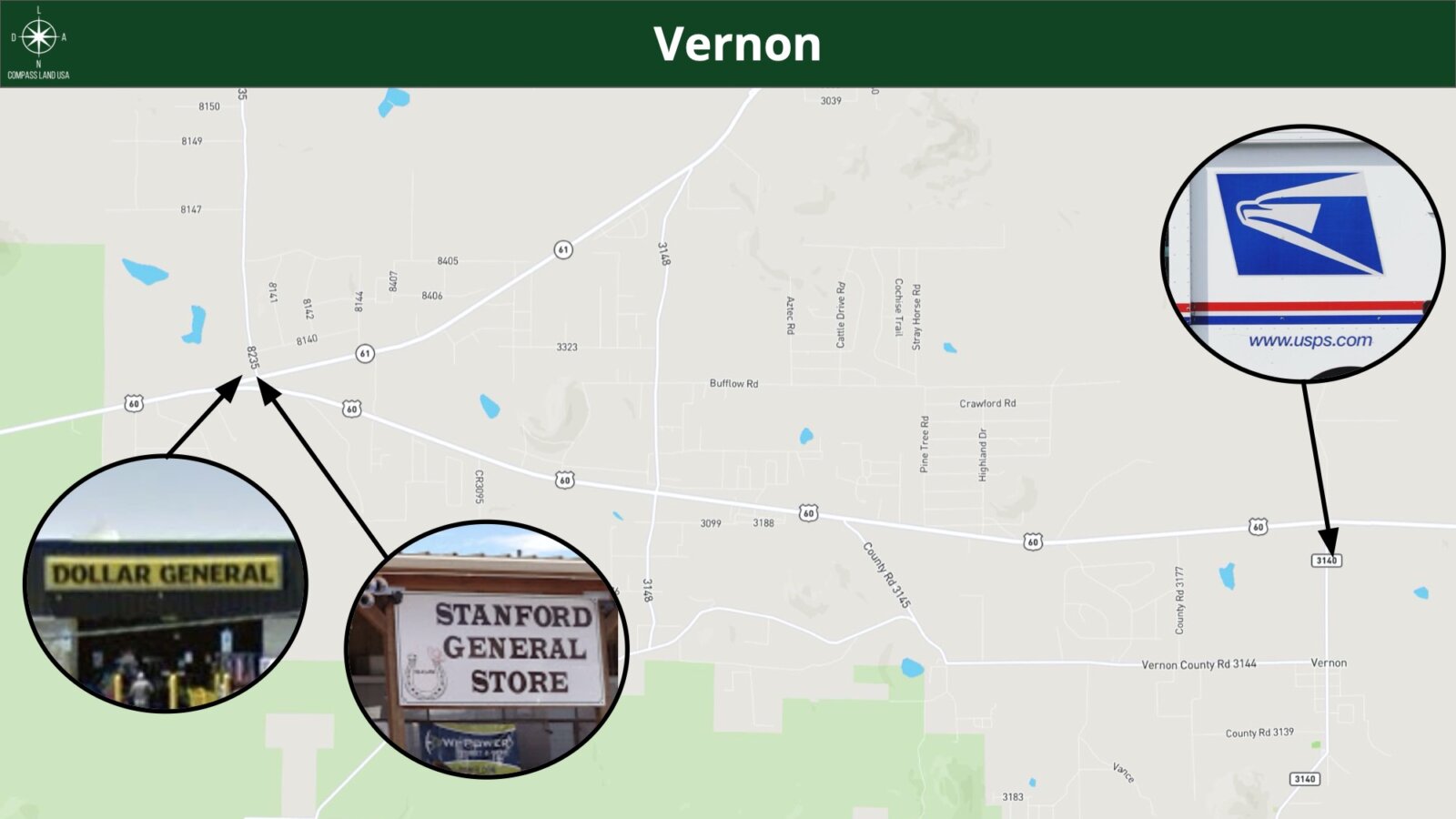
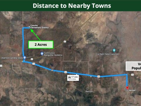
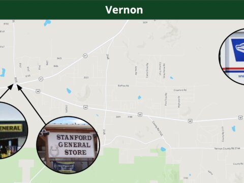
17 minutes to Vernon : Population 160
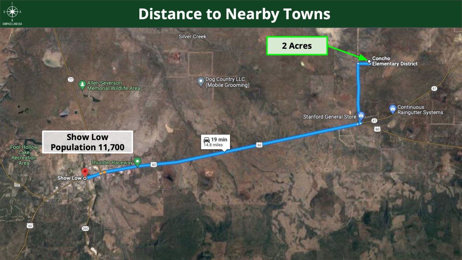
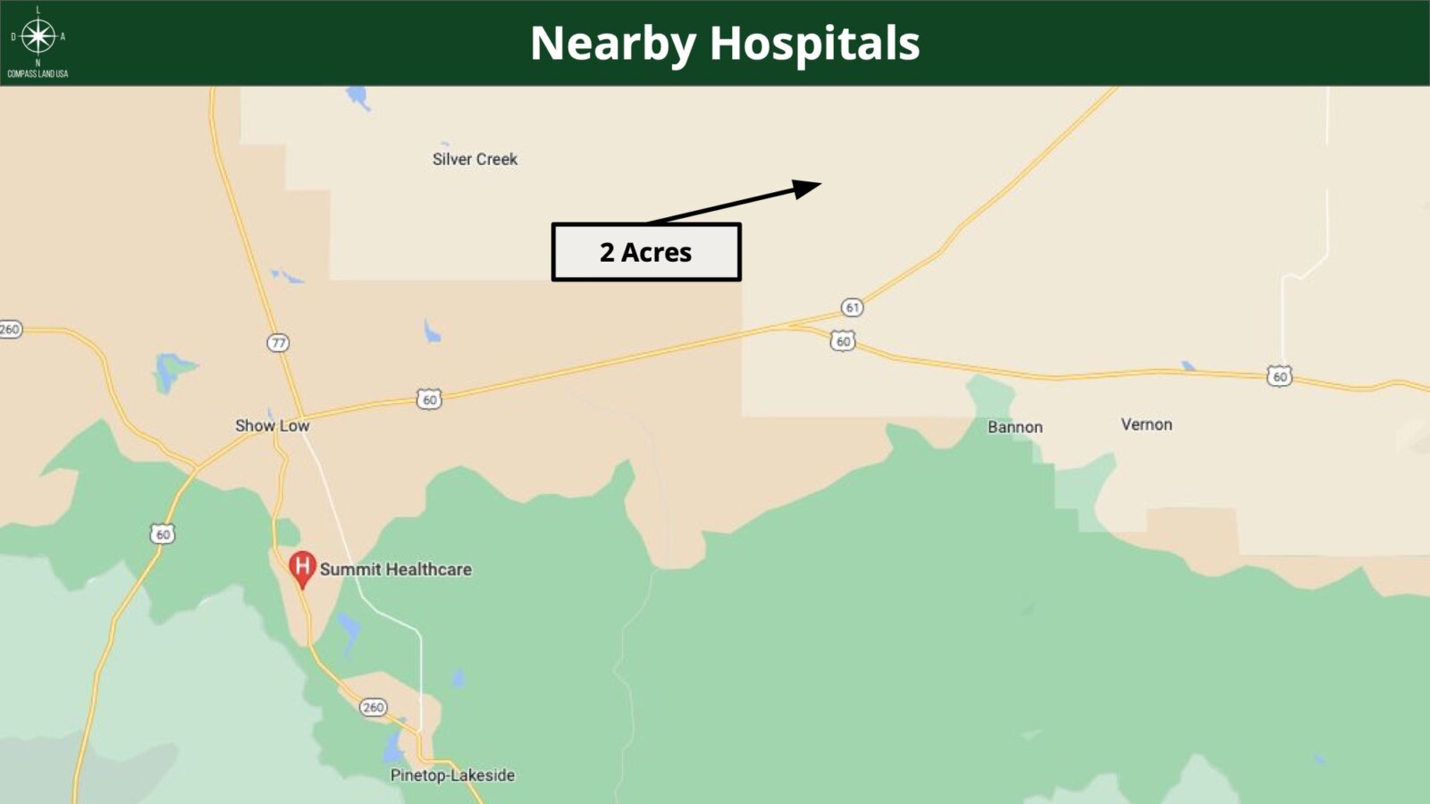
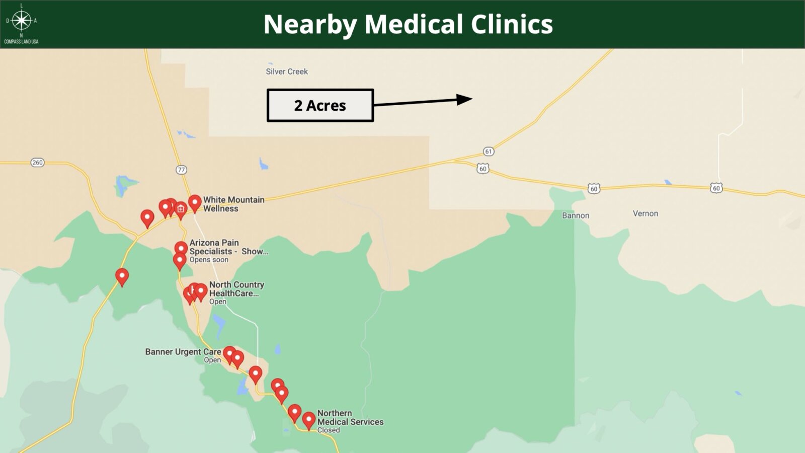
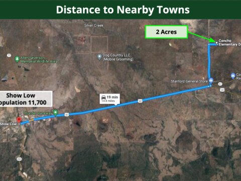
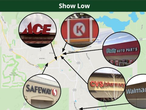
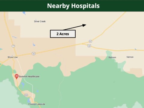
19 minutes to Show Low : Population 11,700
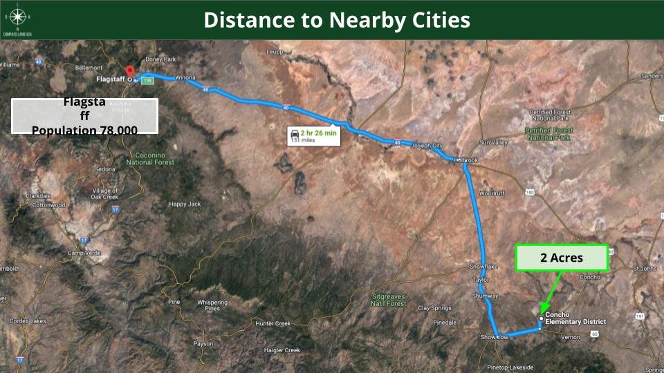
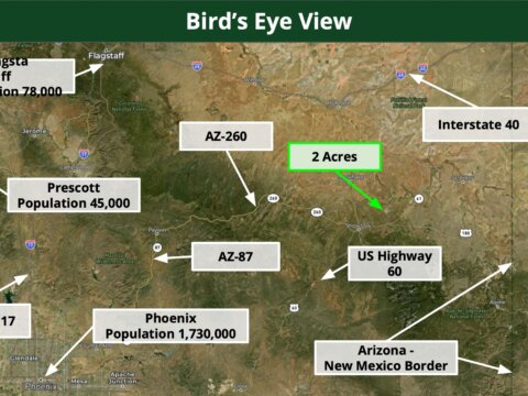
2 hours 26 minutes to Flagstaff : Population 78,000
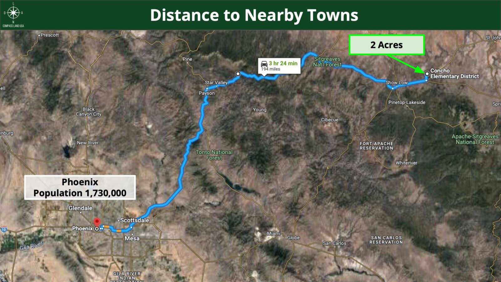
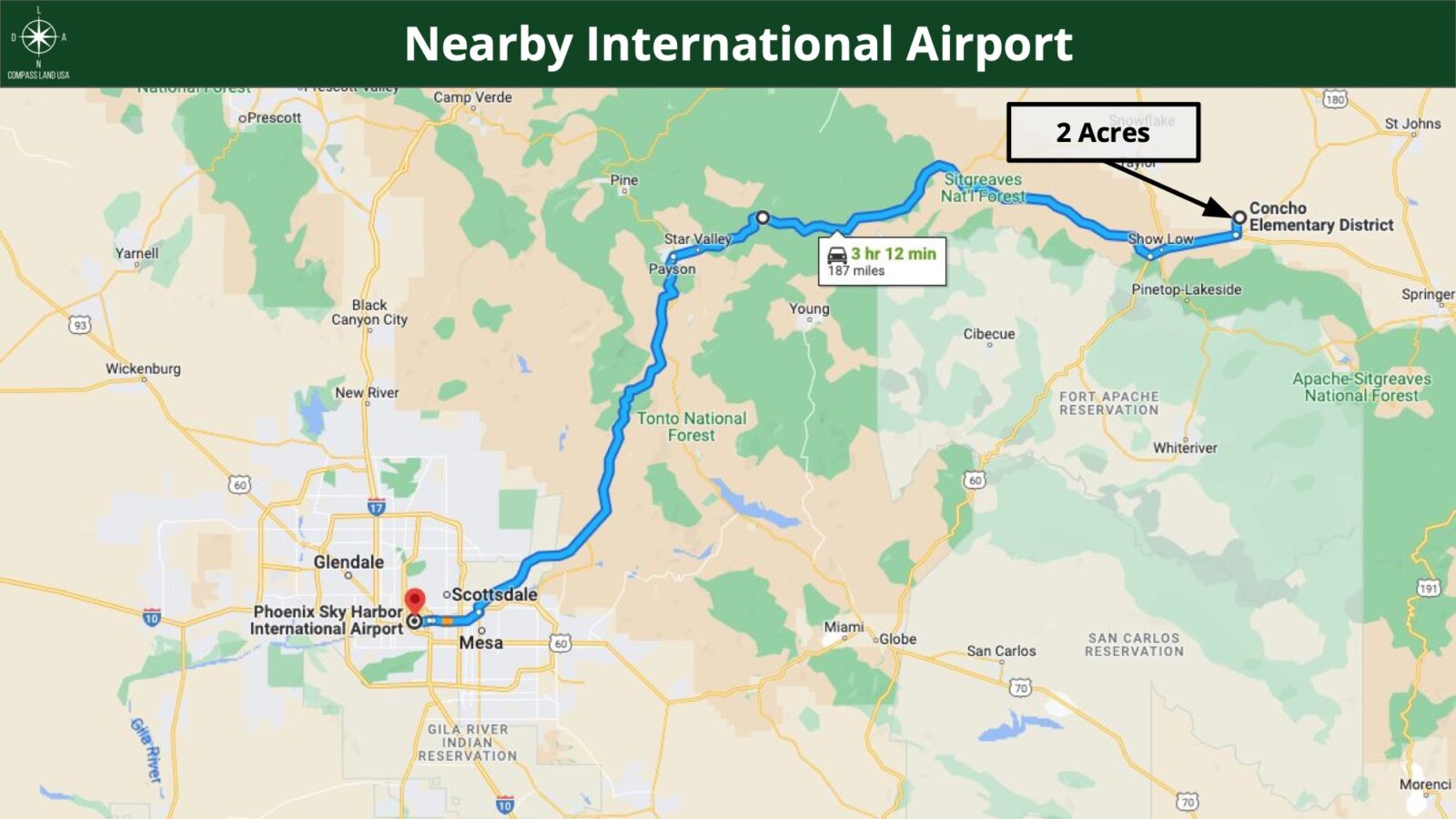
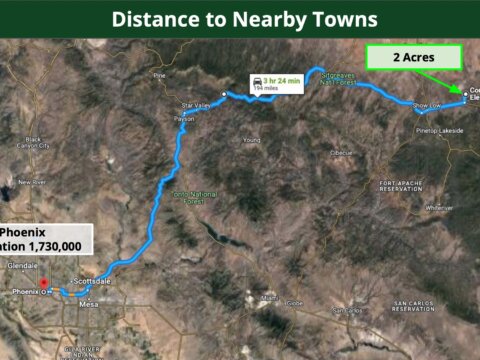
3 hours 24 minutes to Phoenix : Population 1,730,000
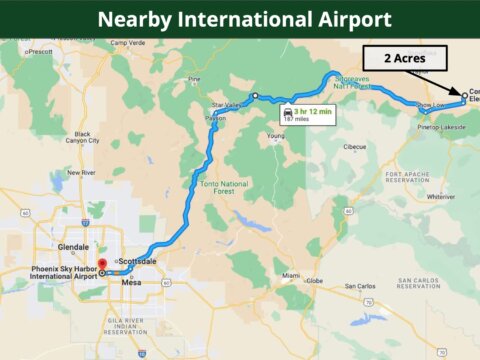
3 hours 12 minutes to Phoenix Sky Harbor International Airport
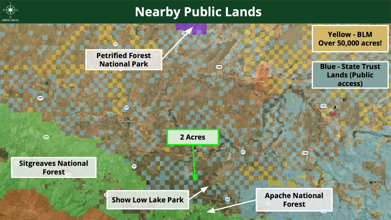
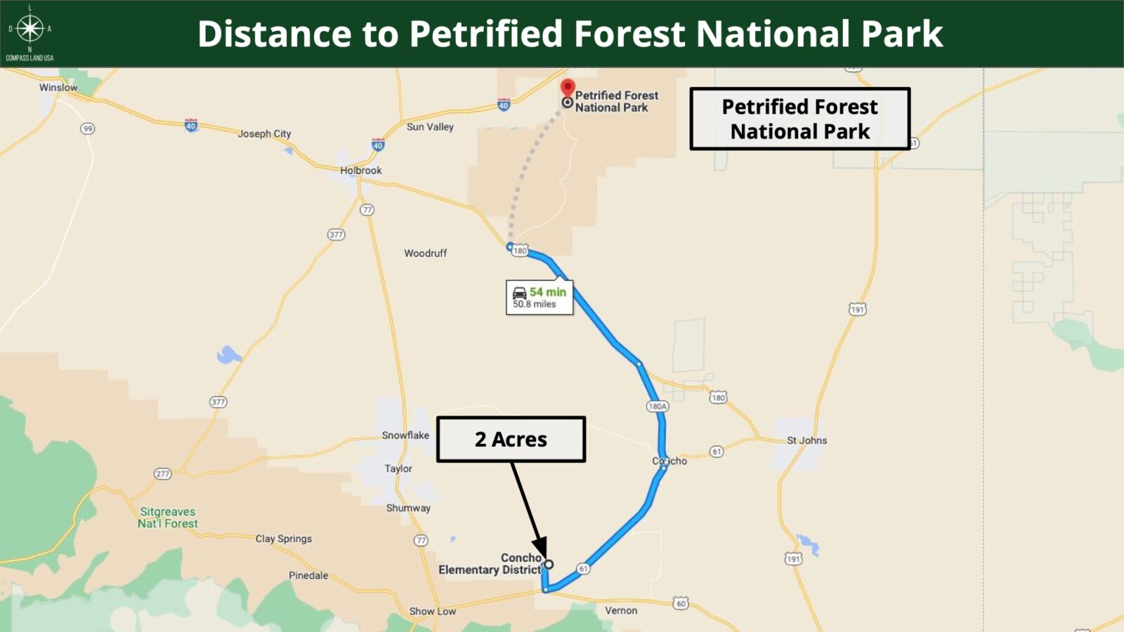
Points Of Interest
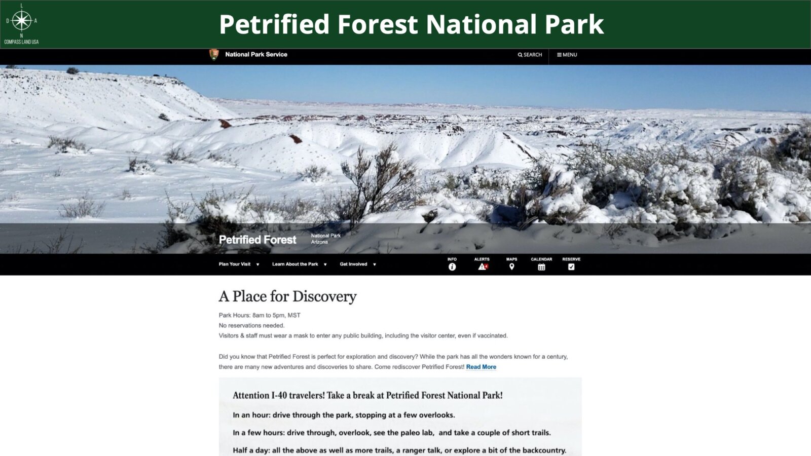
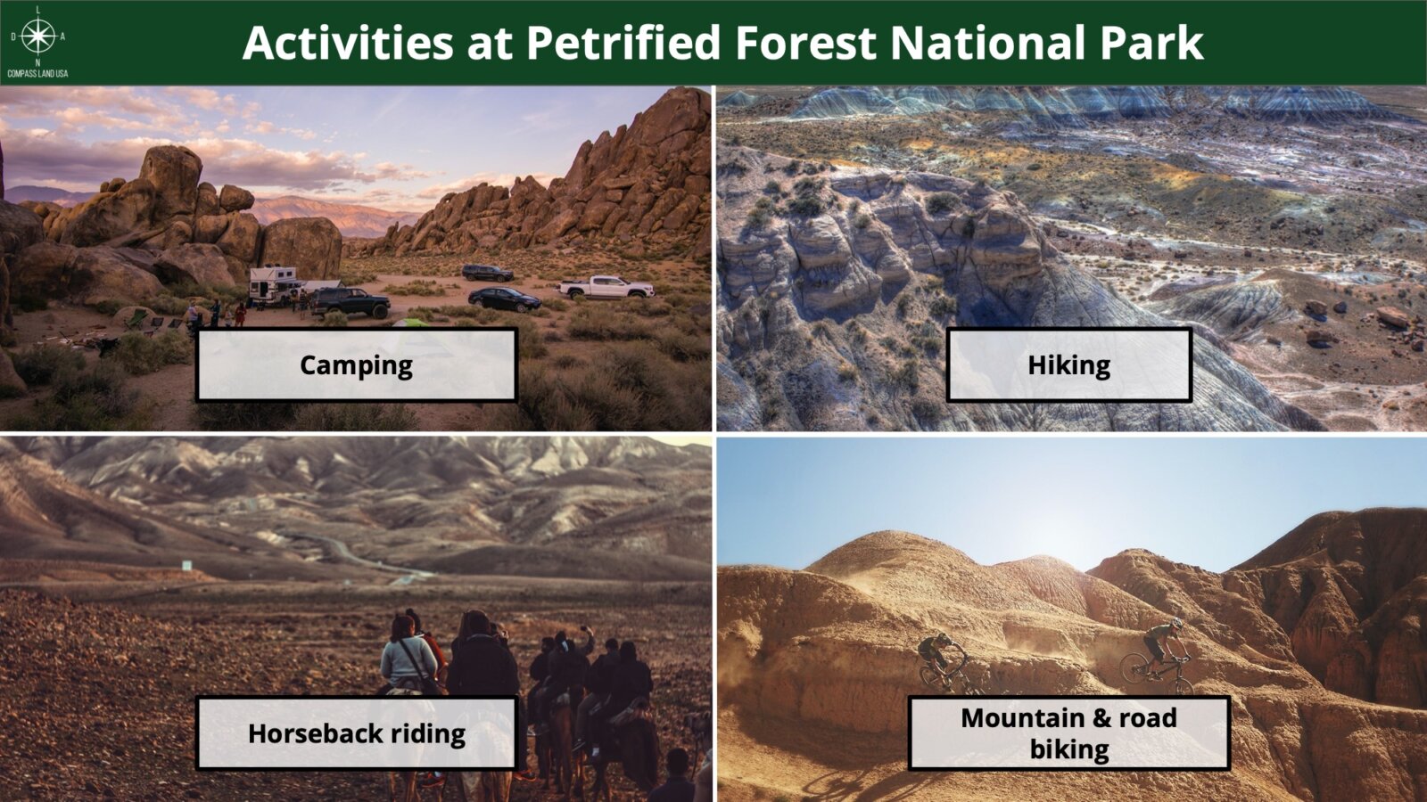
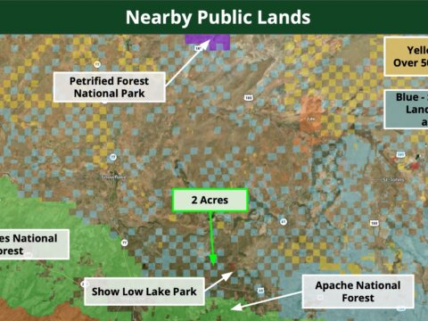
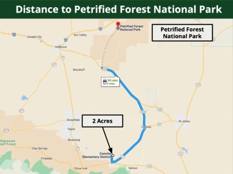
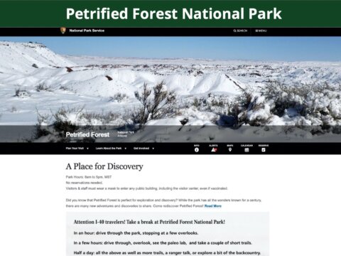
54 minutes to Petrified Forest National Park
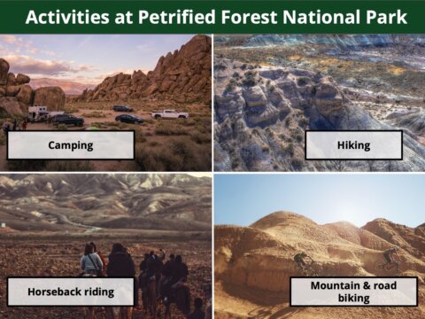
Activities at Petrified Forest National Park: camping, hiking, walking, mountain and road biking, overlanding, horseback riding
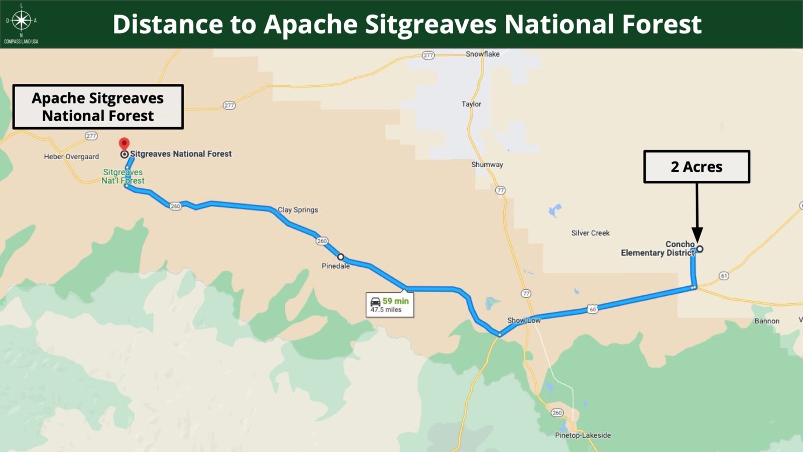
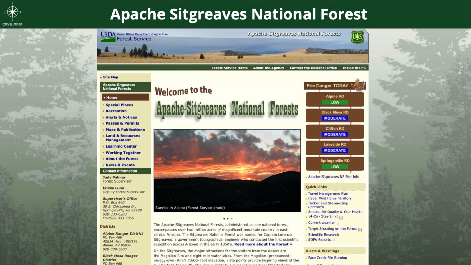
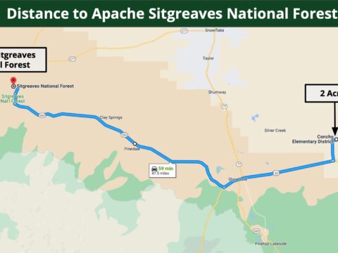
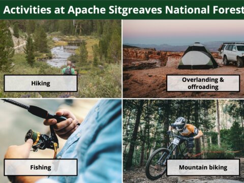
59 minutes to Apache Sitgreaves National Forest
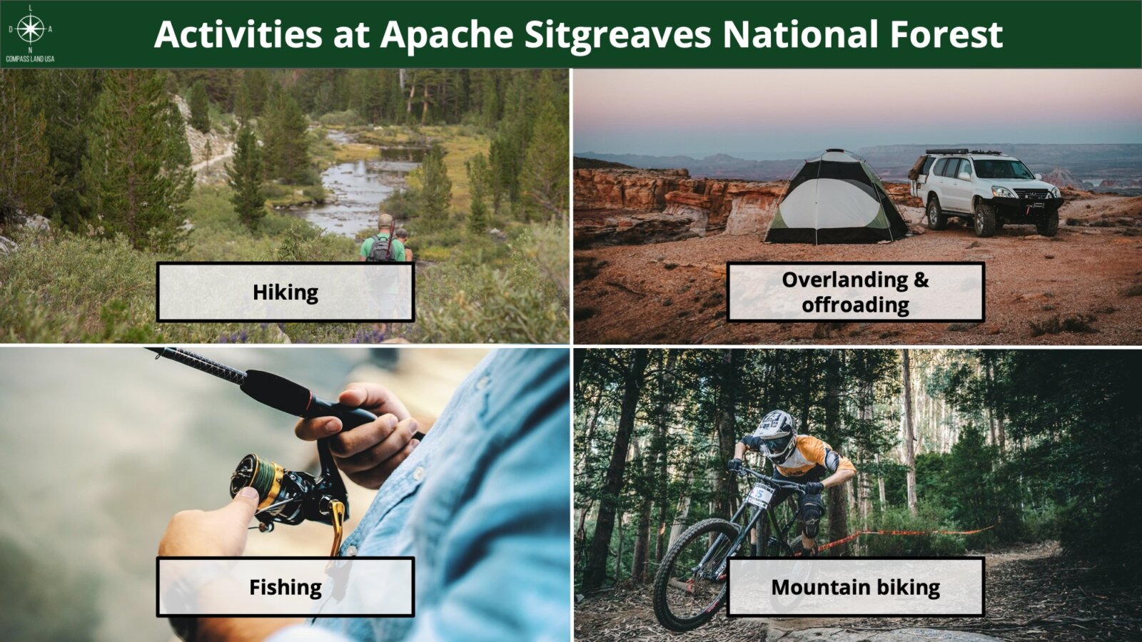
Activities at Apache Sitgreaves National Forest: hiking, fishing, walking, mountain and road biking, camping, overlanding, off-roading
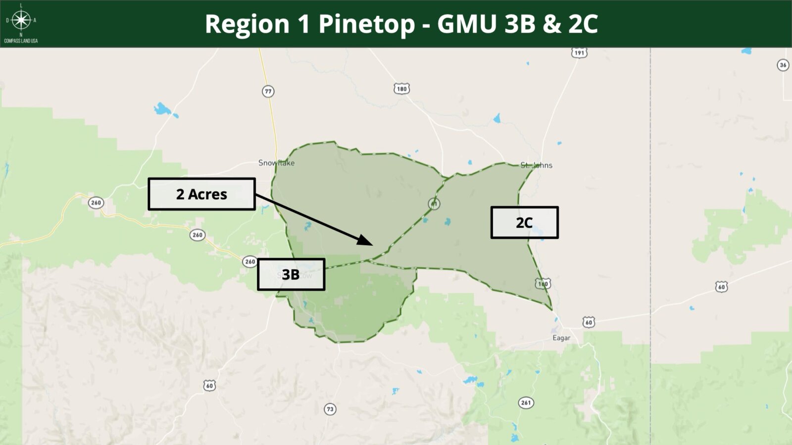
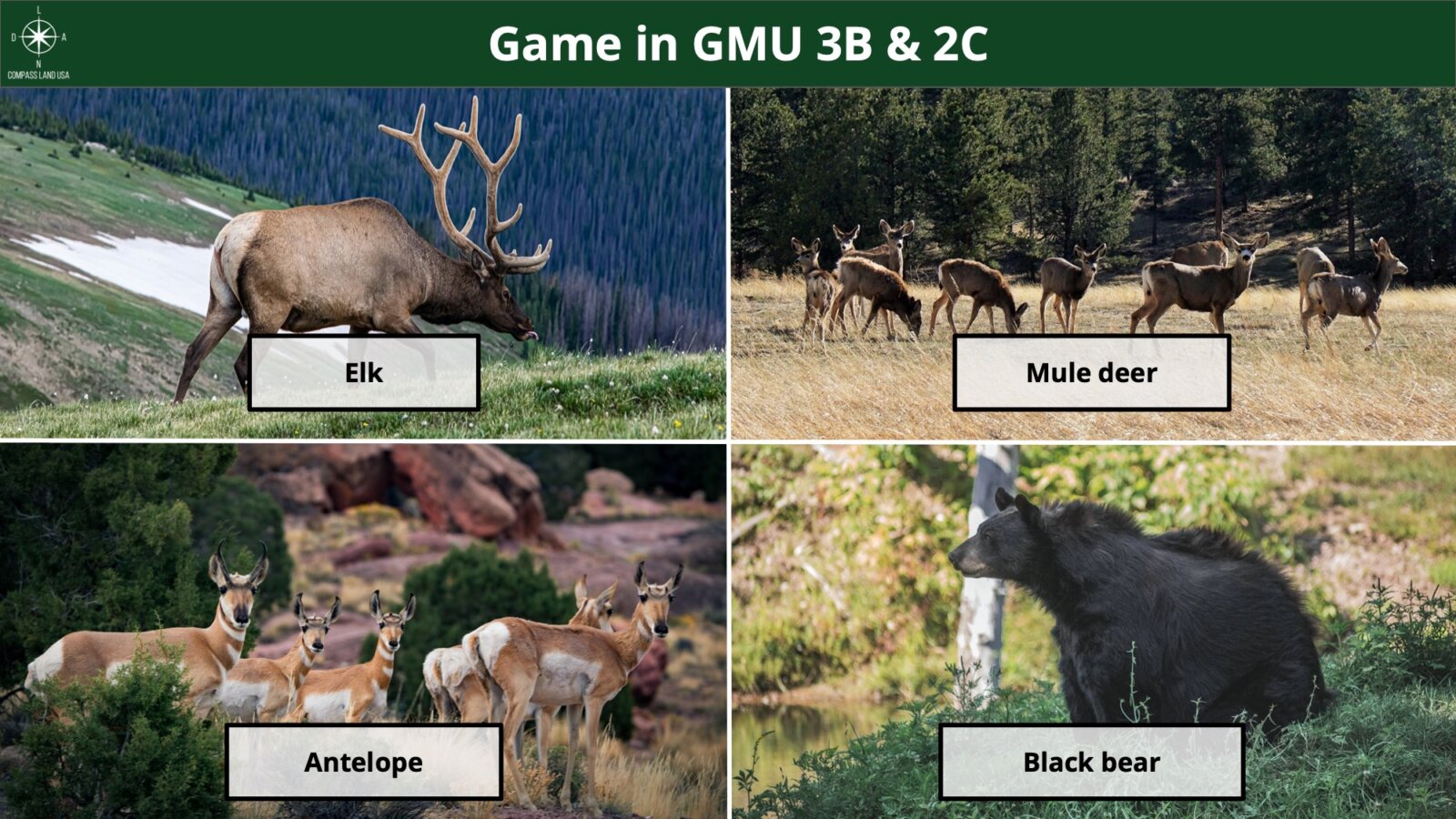
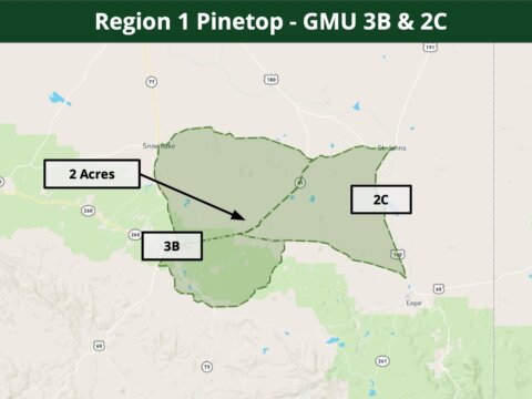
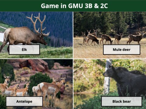
Are you a hunter or fisherman? Property is bordering Game Management Unit 3B and 2C in Region 1 Pinetop.
Nearby game includes: elk, mule deer, black bear, antelope
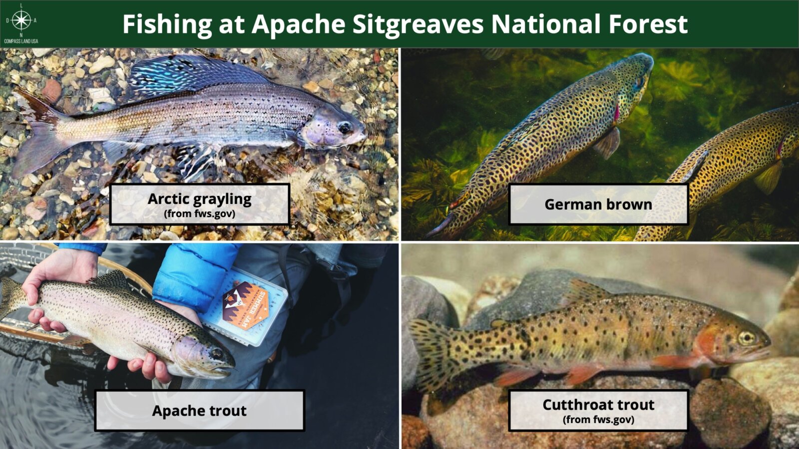
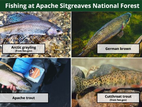
Nearby fish includes: arctic grayling, german brown, apache trout, cutthroat trout
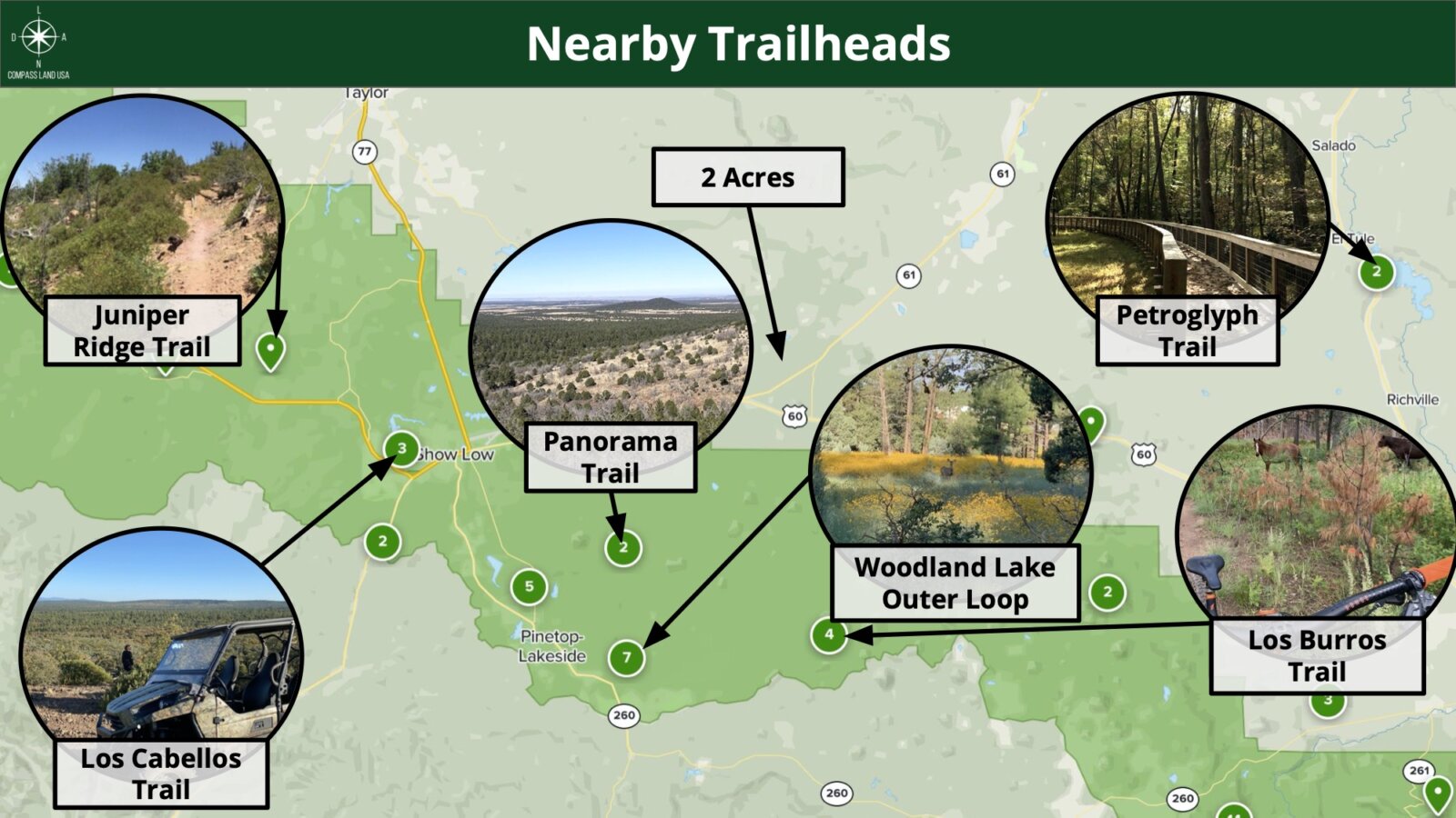
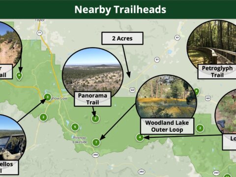
Lots of nearby walking, hiking, and biking trails to choose from: Juniper Ridge Trail, Panorama Trail, Petroglyph Trail, Woodland Lake Outer Loop, Los Burros Trail, Los Cabellos Trail
Call or Text us anytime for questions or to learn more about how to purchase this property.
Worked with Andrew and Felicia buying 5 properties. Very smooth and easy transactions. Will buy from them again.
— Greg Mathews, Colorado Land Buyer
About Compass Land USA: Hello from Felicia and Andrew! We started Compass Land USA to help you easily and safely buy land. ✓ All the recording and closing costs are covered by us – putting more money back in your pocket! ✓ You don’t need a credit check or proof of income, you qualify when you submit the down payment and Documentation Fee. ✓ Your personal information is kept safe with our secure checkout system.
What happens if I click these buttons? You will be taken to a secure checkout page to submit the Documentation Fee. Once processed, we will let you know and immediately start working on the sale agreement.